The Washington County Sheriff’s Office has received the following update regarding the active wildfire known as the West Valley Fire near Pine Valley. Please review the following information before heading to the area for recreational purposes. We would also like to remind the public that restrictions will be in place for the operation of unmanned aircraft (drones) throughout the operation. Violations may include jail and /or fines.
For Immediate Release
June 28, 2018 at 9am
Contact:
Bode Mecham
West Valley Fire Information Officer
Cell: (435) 691-3924
Wildfire Fact Sheet- West Valley Fire
Note: Get the latest fire updates on Twitter @UtahWildfire
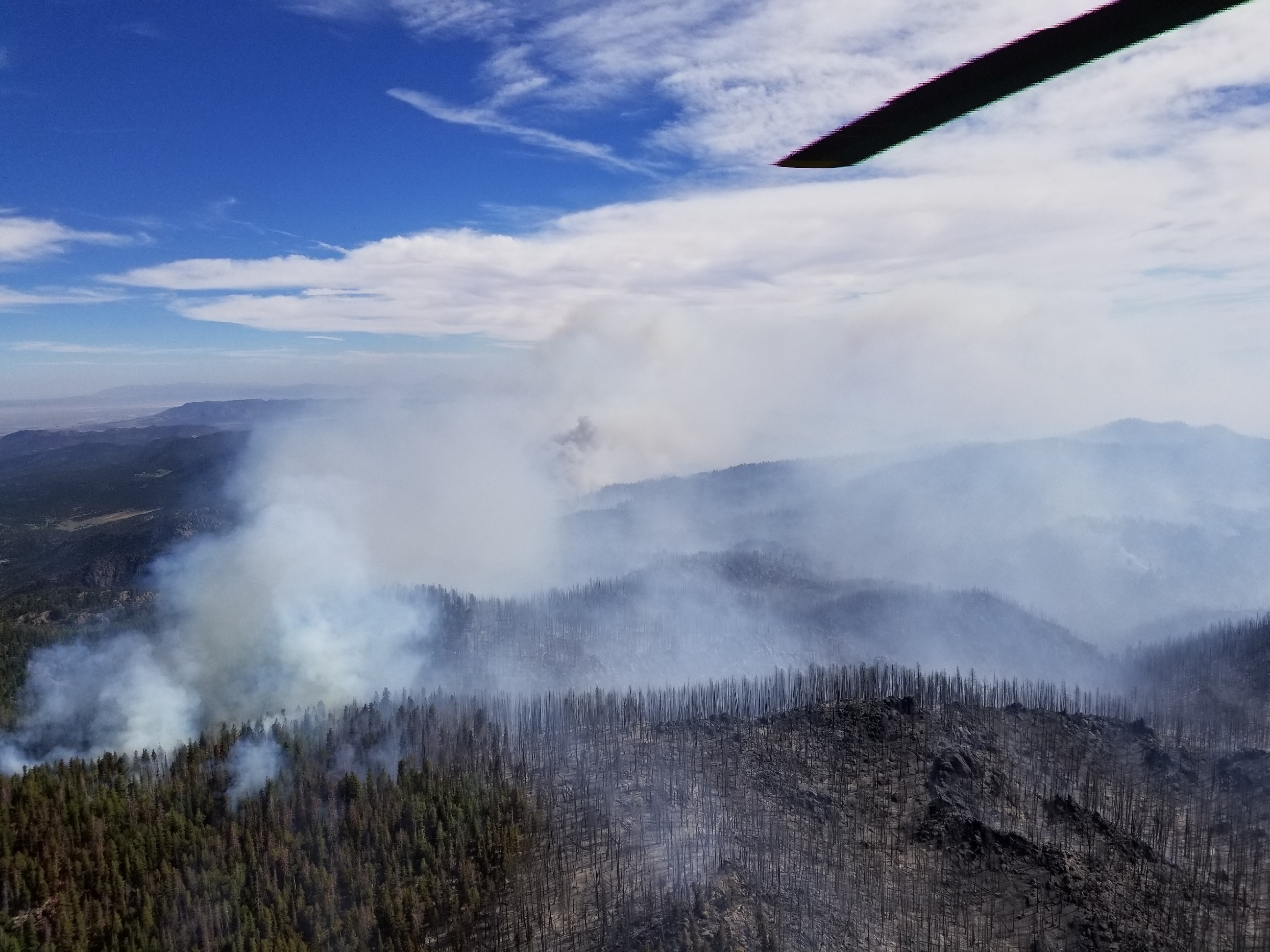
Summary: The fire burned actively throughout the night and grew an estimated 500 acres. The fire will be mapped later this morning for a more accurate size. A national Type 2 Team is ordered and will bring more resources to the incident. A Red Flag warning is in effect for today and is expected to create containment challenges for firefighters. Smoke will be visible from most of Iron and Washington Counties. The fire investigation remains ongoing.
Start Date: Wednesday, June 27, 2018- approximately 2:59 p.m.
Location: One mile east of Gardner Peak, three miles northeast of Pine Valley Campground.
Jurisdiction: Dixie National Forest, Pine Valley Ranger District.
Fire Size: Estimated 2,500 acres (Note: one acre is equivalent to one football field)
Cause: Under Investigation.
Fire Behavior: The fire is currently active and is visible from multiple locations throughout Iron and Washington Counties.
Closures: -Summit trail at the junction of browns point and oak grove is closed 31021
-Whipple trail 31025
-Browns point trail 31008
-Canal trail up on Gardner peak trail
-Water canyon trail 31024
-Mill canyon 31013
-North summit 31021
-High line trail 31027
-Syler spring 31051
-Anderson trail 31022
-Comanche 31011
-Long flat 31050
-FS road 011 from grass valley to road 919 will be closed
-White rocks trail 31014
-Rock springs trail 31019
Structures Threatened: Approximately 10 homes on private land, near the Mill Flat Trailhead, located three to five miles from the fire.
Percent Contained: 0%
Fuels: Timber, Mountain Brush, and Grass.
Fire Crews/Resources: 8 Fire Engines, 6 Handcrews, 3 Heavy Airtankers, 2 Helitankers, 2 Helicopters, 4 Single Engine Air Tankers (SEATs), and 2 Air Attack Platforms are assigned. Five additional handcrews are ordered.
Evacuations: No evacuations.
Injuries: No injuries reported.
For more information on fires in Utah visit www.utahfireinfo.gov.